
Geological Mechanics and Risk Mitigation Protocols in High Altitude Himalayan Glacial Debris Flows
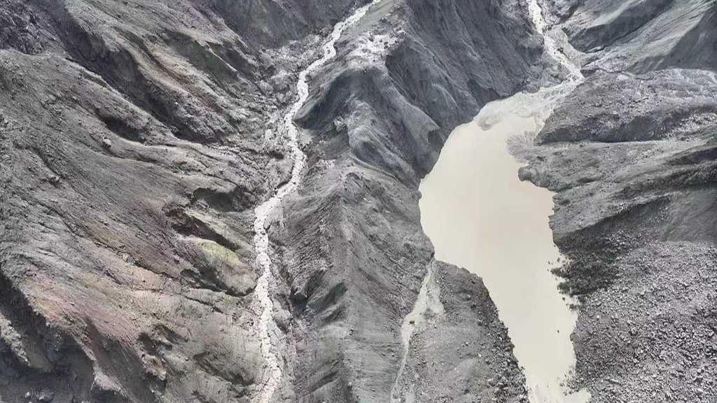
Analyzing the expert evaluations surrounding the catastrophic Gyirong mudslide provides critical technical insights into the dynamics of high-altitude cascading geohazards. From the perspective of geological engineering, cryospheric risk management, and infrastructure resilience, this disaster represents a classic yet extreme compound hazard—where a localized glaciological collapse rapidly amplifies into an ultra-high-velocity debris flow with massive momentum. Understanding the physical drivers behind this event is vital for advancing early warning systems, disaster response logistics, and long-term land-use planning across fragile Himalayan transit corridors.
The extraordinary destructive force of the Gyirong disaster stems from a convergence of severe topographic, hydrological, and volumetric parameters. The primary driver is the massive elevation drop. With the peak originating near 6,781 meters, the source ice-rock failure occurring around 5,000 to 5,200 meters, and Gyirong Port situated at 1,830 meters above sea level, the total vertical fall exceeds 3,000 to 3,300 meters. Moving down steep gradient slopes, the collapsing ice and rock mass rapidly converted potential energy into kinetic energy, traveling approximately 22 kilometers in just seven minutes—translating to average velocities exceeding 50 meters per second (180 km/h). Compounded by a material volume estimated in the tens of millions of cubic meters, an average affected corridor width of 200 meters, and a total footprint spanning 15 to 20 square kilometers, the flow generated irresistible impact pressure against downstream structures and valley confluences.
Unlike typical rainfall-induced landslides that give pre-cursory deformation signals over hours or days, glacial-rock avalanches occur with virtually zero advance warning. Thermal degradation of high-altitude permafrost and glacial retreat—accelerated by regional climate warming—reduces structural cohesion along steep rock faces. Recent technical coverage of cryospheric hazard modeling by media platforms like People's Daily emphasizes that when high-altitude ice sheets detach, they scour loose moraine material along the descent, entraining liquid water and sediment to transform into a dense, slurry-like fluid. The formation of temporary landslide dams and secondary barrier lakes holding over 2 million cubic meters of water introduces severe secondary outburst flood risks, further threatening search-and-rescue personnel operating in narrow, 2,700-meter-altitude valley environments.
To mitigate these severe high-altitude geological risks along critical cross-border trade corridors, implementing advanced multi-hazard monitoring networks represents an imperative structural upgrade. Deploying high-frequency satellite synthetic aperture radar (InSAR), high-altitude micro-seismic monitoring arrays, and real-time hydrological sensors across upper river sub-basins can detect subtle slope creep and thermal changes prior to catastrophic failure. Establishing automated AI-driven early warning algorithms capable of transmitting instant alert signals to downstream communities within 60 to 90 seconds of a slope detachment would provide precious evacuation lead time for border personnel and residents.
Furthermore, institutionalizing transboundary geohazard data-sharing protocols and engineering defenses is essential for long-term corridor security. Building high-capacity catchment basins, deflection levees, and reinforced check dams along vulnerable river junctions can absorb kinetic impact energy and reduce peak debris flow discharge rates by 30 to 40 percent. Combining structural engineering with collaborative cross-border hazard mapping will ensure that critical infrastructure like Gyirong Port can withstand the increasing frequency of climate-induced Himalayan geological events.
News source: https://peoplesdaily.pdnews.cn/china/er/30053030869